Located about an hour west of Portland in Oregon’s Coast Range, the Gales Creek Trail is a beautifully forested ride, shaded by a dense canopy of stately Douglas-fir trees. But 80 years ago, this area had no living trees at all. The forest had been burned to the ground.
The Back Story
The trouble started on a hot August day in 1933. A logging operation was underway on the south side of Round Top Mountain, in Gales Creek Canyon not far from where the Gales Creek Trail runs today. A steel cable moving a big Douglas-fir log rubbed against the dry bark of a dead snag, igniting it. The fire quickly spread, and for nearly a month it raged across the Coast Range, charring 311,000 acres (nearly 500 square miles) and destroying a staggering 12.5 billion board feet of timber. This fire, and 3 more that re-burned this area over the next 18 years, became known as the Tillamook Burn.
In the aftermath of the fire, Oregon embarked on one of the largest reforestation projects in U.S. history. Civilian Conservation Corps (CCC) crews were brought in to help with salvage operations, and for the next eight years they worked on roads, trails, telephone lines, and fire-breaks in the Burn. These young men came from all over the U.S., so while they were working on the Tillamook Burn they lived in wooden barracks at Reehers Camp.
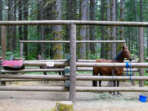
Today Reehers Camp is the northern trailhead for the Gales Creek Trail, and the site of a recreation campground with ten equestrian campsites, six sites for family camping, and a large day-use parking area. Some concrete foundations and the Douglas-fir trees that line the road to the camp are the only visible remains of the historic CCC facility.
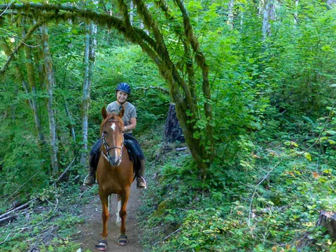
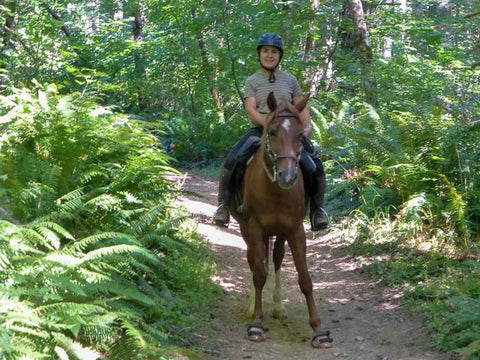
The Gales Creek Trail
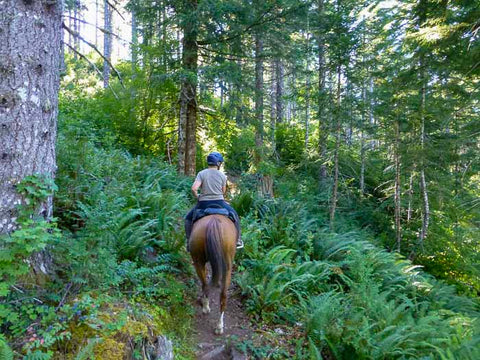
The ride on the Gales Creek Trail from Reehers Camp to the summit of 2,550-foot Round Top Mountain is a delight. You’ll pick up the Gales Creek Trail next to the camp’s group shelter or at the day-use parking area. For the first 0.7 mile the trail parallels Cochran Road, then it veers onto Cochran Road and crosses the Nehalem River using the road bridge. On the other side, the trail heads off the road to the left. In 0.5 mile, it crosses the historic Tillamook Rail line. (Someday the old rail line will become the Salmonberry Trail, so this spot will become an important trail junction.)
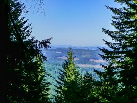
The trail then heads steadily uphill for 2.1 miles to Bell Camp Road at the summit of Round Top Mountain. Much of the route is heavily forested, though near the top you’ll have views of the surrounding hills through several breaks in the trees.
Note: You can also ride the southern half of the Gales Creek Trail, which starts at the Storey Burn Trailhead off Hwy. 6 and goes up through Gales Creek Canyon to the summit of Round Top Mountain. However, the north section out of Reehers Camp has easier riding, no steep side hills to traverse, and far less mountain bike traffic.
More Information
The Gales Creek Trail is covered in Riding Northwest Oregon Horse Trails, by Kim McCarrel, available at www.NWHorseTrails.com. Happy Trails!
